 |
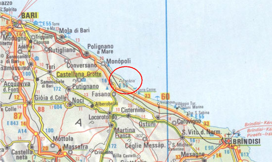
| The city Egantia is in the middle between Bari και
Brindisi |
Gnathia, or contemporary Egnazia, which was named Egnatia during the Roman
period, was a city greatly affected by the cultural influence of the Greeks.
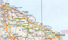
Situated between Bari and Brindisi, the city bloomed significantly, as
the detour of the Appian Road traversed it, the Tarjan Road (Via Traiana),
which was preferred over the initial mapping of the Appian, since it was
the shortest way to Brindisi (for centuries the departure port towards
the Balkan Peninsula). The city was founded in the 16
th century
B.C. The first inhabitation of the area took place on the small peninsula,
a natural fortress facing the sea. In the forthcoming centuries, the acropolis
of the city was built on this peninsula, while the city extended to the
west, to the fertile planes of Apulia. From the prehistoric period there
have been some known commercial relations with the island of Corfu, and,
even further, with Corinthus. The harbour of the city that is found today,
under the waters of the Adriatic Sea for its most part, had been formed
in such a way in order to welcome the big ships of the time.
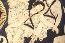 |
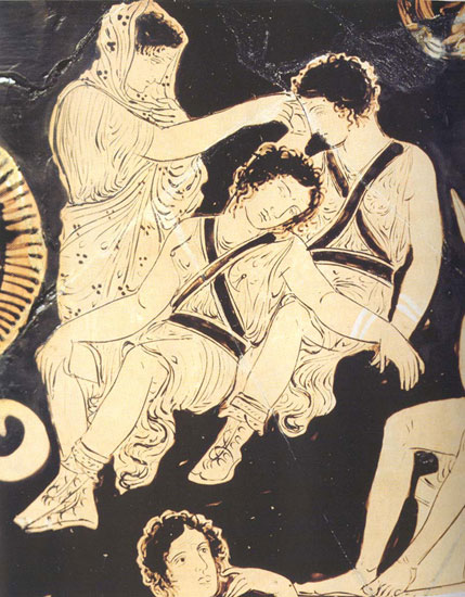
| Vase painting from Puglia. Paris, Louvres Museum |
The life of the city has continued uneventfully for the next centuries, while
its inhabitants also acquired the identity of the Messapians, who progressively
took over the whole region of Apulia. The quiet life of the city was disturbed
by the founding of Taras in 706 B.C. The city had progressively acquired a fortification
wall during the 4th and the 3
rd century B.C. in order to be protected
against the expansive intentions of the Tarantians; the city also possessed a
street-plan and was developed into a contemporary city of that period, influenced
by the typology of the Greek cities and their cultural characteristics. The occupation
of Brindisi (Brundisium) by the Romans in 244 B.C. and the Trajan Road, which
was named Via Appia – Via Traiana at this particular section, were the two most
potent factors initiating the city’s development which had gradually acquired
some Roman characteristics, still visible to the modern visitor. The extent
of the city covered an area of 40 hectares; it flourished in the imperial period,
during which it acquired a modern harbour that was carved on the rocky coast
at several points.
 |
| Drawing of ancient Egnatia. The red line denotes the wall of the city, which formed a semicircle open to the sea. Α Β C D are the necropolises of Egnatia. The temple (TEMPLO) lies on the acropolis. One can also see Via Appia –Traiana which traversed the centre of the city (brown line). |
| |
Horace (65-8 B.C.) in his voyage from Rome to Brindesium, at the end of
the 1
st century B.C., mentions Egnatia in a poetical way (
«
Gnathia lymphis iratis exstructa »), as a city full of sea nymphs;
just a few lines before this, in the description of his voyage, he mentions
that he reached the area under heavy rain, which meant that he must have
seen the boisterous Adriatic sea, splashing on the rocky shores of the
city. Horace mentions the bad condition of the road, as in his time the
Trajan Road (Via Traiana) had not yet been constructed. During the Byzantine
period, the city remained a significant site of the area and during the
5
th and 6
th century, three old Christian basilicas
replaced the older, Roman administrative buildings which became also the
seat of a bishop.
The coming of the Goths, in the 6
th century,
led
gradually to the city’s decline, even though some fortification installations
were observed, in the next centuries constructed by the Byzantines,
who, after defeating the Goths, battled to prevent
the charge of the Longobards. The city was finally abandoned in the 10th century, at a time when the Byzantines
were gradually withdrawing from Italy.
Despite only a few mentions of the ancient Egnatia (Egnazia), the excavations
in the city, and more specifically at its necropolis, brought to light
the well known «Gnathian vases», which were decorated with red, yellow and white
colour on a coat of black varnish.
 |
 |
 |
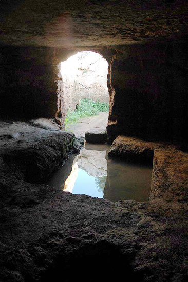
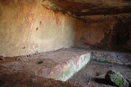
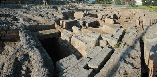
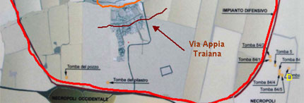
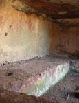
| The necropolises of Egnatia were
mainly outside the city walls and their larger sections were
carved in the rocks of the area. |
| |
 |
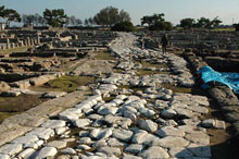 |
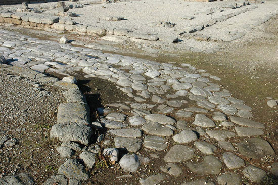
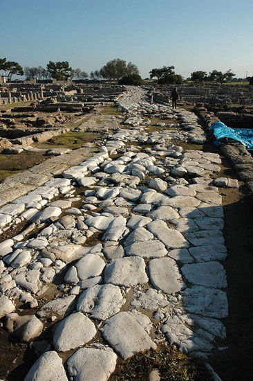
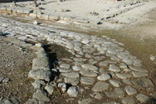
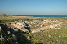
| Via Appia – Traiana, which traverses
Egnatia, started from Benevento (Beneventum) and ended in Brindisi
(Brundisium) |
| |
 |
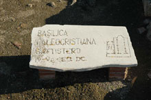 |
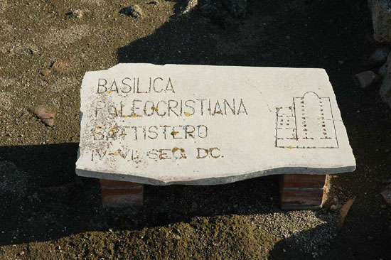
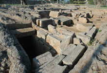
| One of the three basilicas built
during the Byzantine period in Egnatia. |
| |
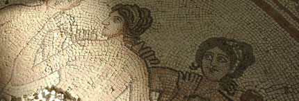 |
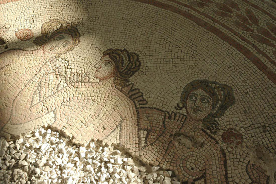
| A mosaic of the 4th century B.C., built into
the old Christian basilica |
| |
 |
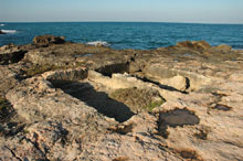 |
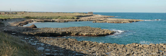
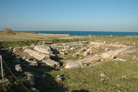
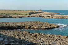
| Part of the coastal zone of Egnatia.
Today, the best part of the coast has sunk into the Adriatic
Sea. The coast of Egantia has formed a safe haven at a naturally
inhospitable section of the coast. Part of it was used as a
necropolis, as well as for storing rain water into carved water
tanks. |
| |
 |
 |
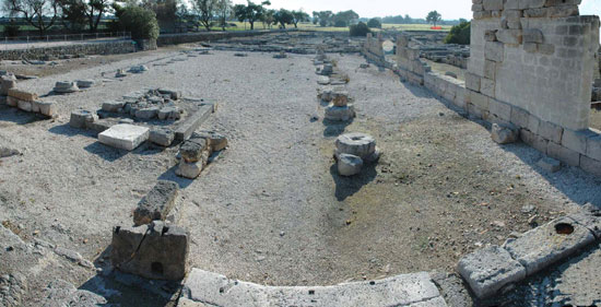
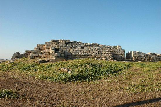
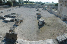
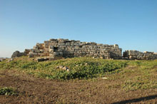
| The acropolis of Egnatia built with carved
blocks of stone according to the Greek system of wall construction |
A temple inside the acropolis |
| |